Types of Numerical Flood Modelling
Numerical flood modelling can assist in accurately quantifying the flood level for your site. Modelling may be required where the Environment Agency’s ‘Flood Map for Planning’ are inaccurate or show more flooding than would be expected. Occasionally, flood level information provided by the Environment Agency (typically called Product 4) may be based on outdated modelling software, not taking account of the latest climate change guidance. In addition, the Environment Agency may object to a development at planning stage, requesting a detailed site-specific flood model to demonstrate that any proposed flood mitigation does not increase the risk of flooding offsite.
Our flood modellers also have extensive experience in supporting water-integrated garden city to evidence to the Environment Agency that the development proposals are viable and meet the NPPF.
We can help in any of these instances and more. Find out more in our brochure.
Fluvial Modelling (Flooding from Rivers)
In the absence of an Environment Agency model (usually found on main rivers), we can build a bespoke site-specific model to assess the risk of flooding and provide you with the flood levels and flood extents needed to inform the scheme design. Alternatively, we can refine and update EA models with more site-specific data to obtain the latest flood level in accordance with guidance.
We can complete both the flood modelling, and the hydrological estimates (flood hydrology) required to drive our models, all while following the EA’s prescriptive guidelines.
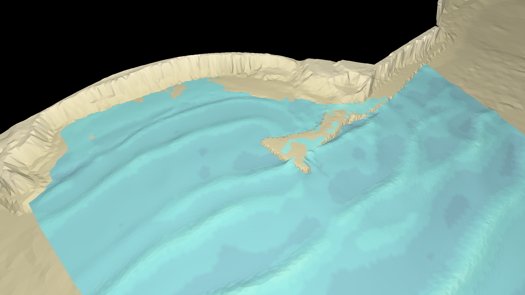
We use industry-standard models and provide graphical outputs that are easy to understand by everyone alike and include all necessary information to enable an informed decision to be made, be it either to support a planning application, or stand-alone to inform development potential for your site.
Pluvial Modelling (Flooding from Rainfall and Surface Water)
Even away from rivers, sites can be impacted by surface water as a result of heavy rainfall – an occurrence prevalent in urban areas where rain can no longer soak into the ground, or the existing drainage network cannot cope with the volume of rainfall.
The EA’s mapping might show that your site is affected by a surface water flow path. Whilst the drainage system is aimed at managing surface water generated from the site itself, any water entering the site from offsite and the surrounding area will need to be taken into consideration. This extra water does not need to be accommodated for in the drainage design and instead can often be routed through and around your site, providing the situation is not made worse for someone else. Lead Local Flood Authorities can often request additional information relating to surface water management and this is where our models can help, by demonstrating that your proposals manage the surface water while not impacting your neighbours.
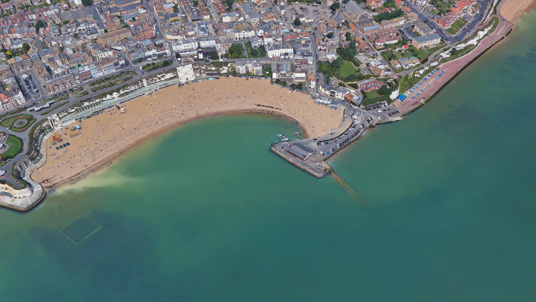
Tidal Modelling (Flooding from the Sea)
Climate change is slowly driving sea levels higher, and sites near the sea, or along estuaries, may now be at risk of flooding where they once were not. Sea defences are sometimes slow to be upgraded, and predictions of flooding from the sea are often slow to be updated to include the ever-changing risks of climate change. Our modelling can provide you with the latest flood levels for your design and advise on mitigation for both Actual Risk (when defences are working to prevent flooding) and Residual Risk (when defences fail).
01Coastal Management
Supported by our in-house numerical modelling team we are able to undertake a wide range of analytical studies focused on coastal processes and shoreline management. These include wave modelling, sediment transport, tidal modelling, wave overtopping analysis, as well as an extensive experience in designing flood and erosion protection structures.